Geobotany and Field Trips
Batelle Darby Metro Park and Cedar Bog State Nature Preserve
Part A: Geobotany of Ohio
What sort of word is geobotany anyway? A hybrid of two! It refers to the study of plants in relation to how their distribution corresponds with their geological habitat and substrate. Therefore, by getting some background in Ohio geology, we will be better equipped to understand Ohio plants.
The geology of Ohio (unless you stare at a map for too long) can be neatly divided into two parts. The western part contains a substrate of mainly limestone (including dolomite) which isn’t very resistant to Ohio’s humid climate. As a result erosion has take its toll in the west to form a relatively flat landscape (eroding over the last 200 million years). By comparison, Eastern Ohio has a substrate of mainly sandstone which holds together better by forming a natural cement and is relatively resistant to erosion. Over time though, water can seep through and dissolve this cement which is why deep ravines can form in southeastern Ohio. The older limestone in the west is quite erodible while the newer sandstone in the east is more resistant to erosion overall. As a result, the west is mainly flat while the east has hills with steep sides and valleys formed by rivers.
Originally, Ohio had a sequence of sedimentary rock strata with sandstone placed on the top layer (closest to the surface) which was on top of shale which covered the limestone. When these three layers were tilted in an arch (product of built up pressure that also formed the Appalachian Mountains), the highest part of the arch (in the west) is where erosion cut the deepest which inadvertently exposed the older layers of limestone. The arch was lowest in the east which is why we still have much of our sandstone remaining.
So how did all this erosion occur? That is all thanks to the Teays (pronounced Taze) River. The Teays was present for about 200 million years and eroded the land the whole time it was present. Its activity was curtailed by the advance of the glaciers which inevitably changed the flow of Ohio’s rivers.
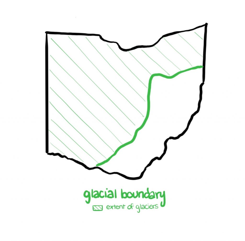
The Teays River disappeared when the Pleistocene Epoch glaciers entered Ohio a few hundred thousand years ago. Glaciers continued to change the landscape after that point until about 20,000 years ago during our last glacial advance by the Wisconsin glacier. The glaciers themselves were slowed down by the steep-sided sandstone hills of eastern Ohio while they easily plowed through western Ohio where there was nothing to stall the advance of the ice. It is due to the sharp difference in limestone vs. sandstone substrate that resulted in a very different landscape which led to the creation of a sharp glacier boundary (see my drawing).
As a result of the glaciers, deposition of material was left behind. This material is called till, which is defined as “an unsorted mixture of sand, silt, clay, and boulders” which are accumulated directly because of the melting of the ice. These materials are then deposited by the glacial meltwater. In western Ohio, the glacial till is high in lime and clay while the till of eastern is low in limestone and clay. All areas of Ohio received glacial sand and gravel deposits from glacial outwash.
As a result of Ohio’s geological history, the flat plains of western Ohio have much limestone and a clay till substrate resulting in an impermeable soil where the pH is limy and not as acidic as in the east. For example, Cedar Bog is a calcareous fen that has a pH that is known for being close to neutral and even slightly alkaline. The soil in western Ohio is also quite poorly drained and inadequately aerated. On the other hand, Eastern Ohio soils are very permeable sandstone bedrock and the exposed bedrock produces a very acidic substrate.
5 Species of Tree with a Distribution Limited to Limey Substrates
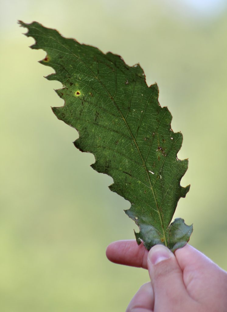
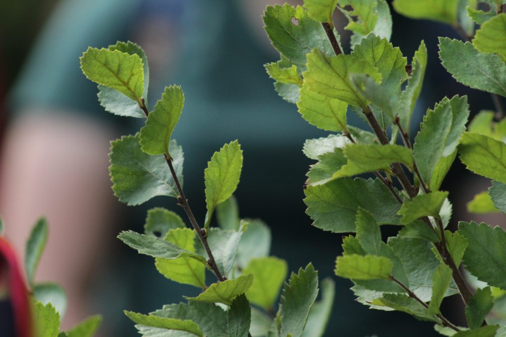
A Chinquapin Oak leaf! You can see the distinctive sharp toothing in the leaf margin that give this oak its recognizable leaf shape.
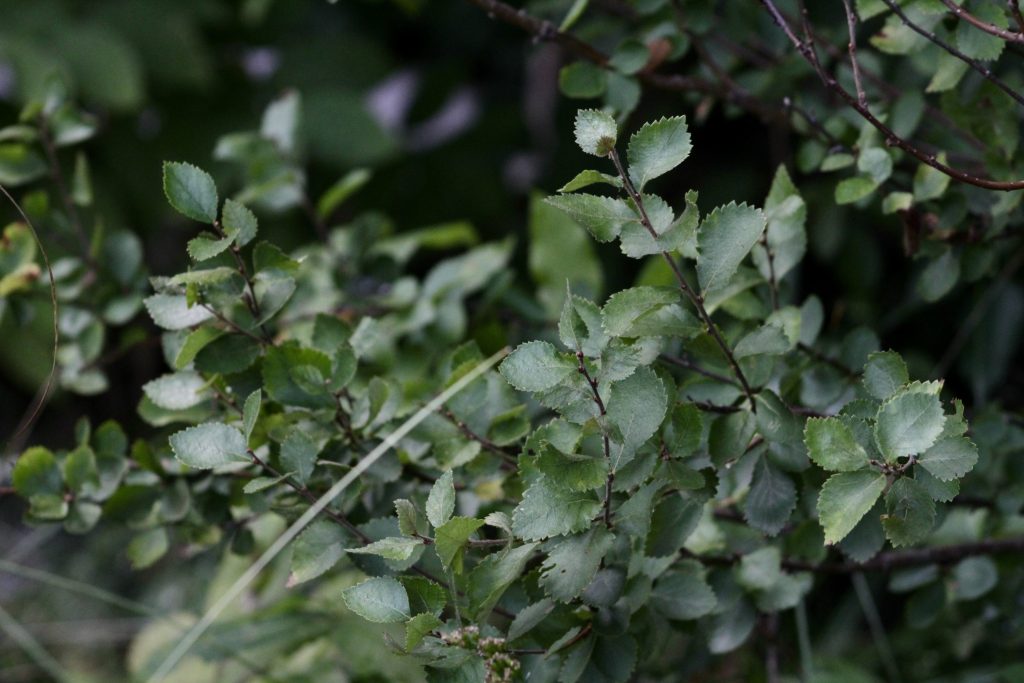
Chinquapin Oak (Quercus muehlenbergii): The Chinquapin Oak’s ideal habitat are dry woods on limestone soils (similar to Cedar Bog although it isn’t a dry environment in the fen). It is a medium-sized tree with sharply toothed leaves. It also produces acorns that are 1-inch in diameter and mature in a single year.
Northern White Cedar (Thuja occidentalis): The Northern White Cedar is also a medium-sized tree with leaves that are scale-like and the central leaves have tiny glands. The cones of the tree are also bell-shaped. The cedar is sometimes also known as arbor vitae as it an evergreen coniferous tree.
Blue Ash (Fraxinus quadrangulata): The Blue Ash often is found in upland woods and is one of our plants that enjoys the fen and limey ecosystem of Cedar Bog SNP and also the Cedar Ridge Area of Batelle Darby Metro Park. In my opinion, the most distinctive feature of this ash is that it has square twigs with the appearance of 4 lines on their sides.
Fragrant Sumac (Rhus aromatica): According to the field guide, Fragrant Sumac appreciates sandy and rocky soils which is probably why we found it at the edge of a deep ravine at the Cedar Ridge area of Batelle Darby. It has trifoliate arranged leaves making it superficially appear like poison-ivy (Toxicodendron radicans) but it has lobed margins on the leaflets and is an often erectly posed shrub.
American Hackberry (Celtis occidentalis): Last, but not least in the photo documentary, we have the American Hackberry. It has sandpapery feeling leaves and to me they have a light green-yellow tone that is unmistakable once you get used to seeing the tree. They also appreciate a limey substrate as well as woods and open places. They also have bizarre, warty bark.
See the following photos to get a visual image of the plants that I described above. All of these specialist species were seen during the Batelle Darby Metro Park (BDMP) and Cedar Bog State Nature Preserve field trip. The source for the descriptions above of the limestone loving plants is from the Peterson Guide to Trees and Shrubs by George A. Petrides.
Chinquapin Oak
(Quercus muehlenbergii)
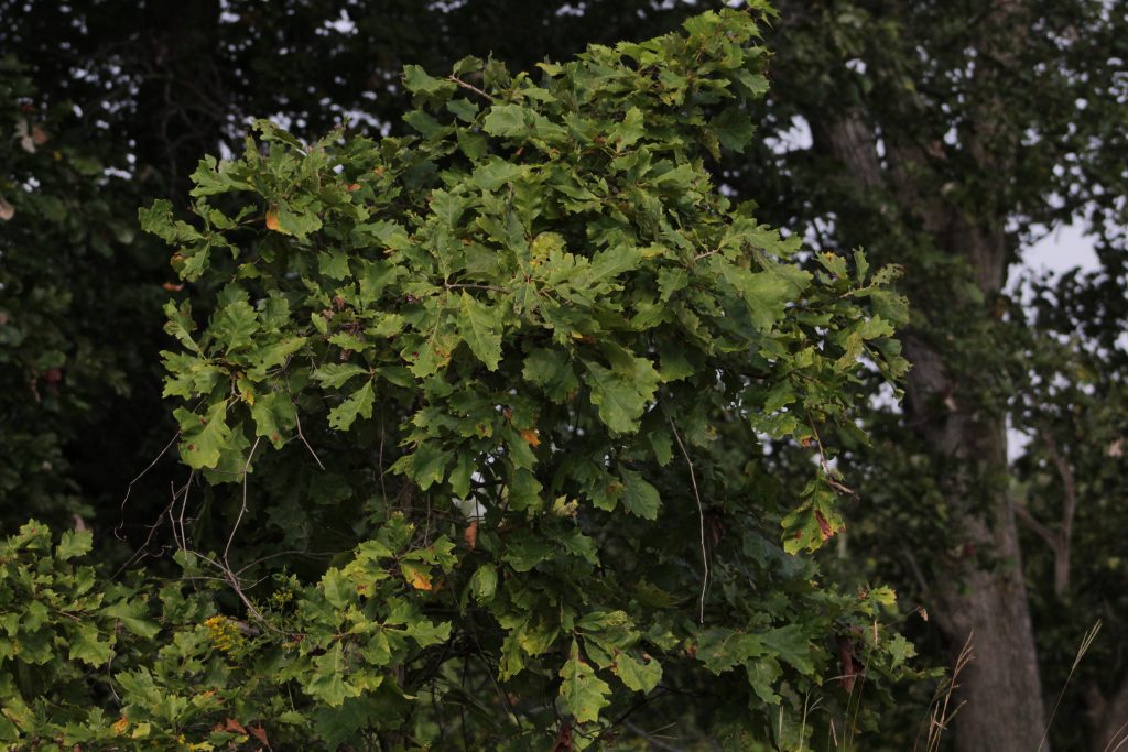
Chinquapin Oak leaves and branches from a farther distance.
Northern White Cedar
(Thuja occidentalis)
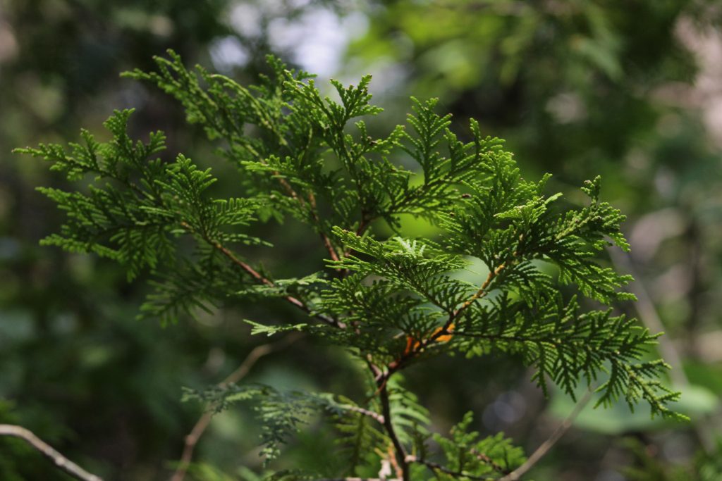
The sprays of the northern white cedar are flattened and aligned vertically.
Blue Ash
(Fraxinus quadrangulata)
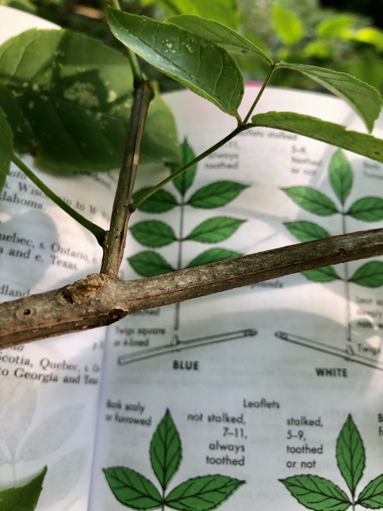
Using the handy Peterson Field Guide to Trees and Shrubs (Petrides) to distinguished a Blue Ash from the other Ashes. You can clearly see the 4-lined twigs.
Fragrant Sumac
(Rhus aromatica)
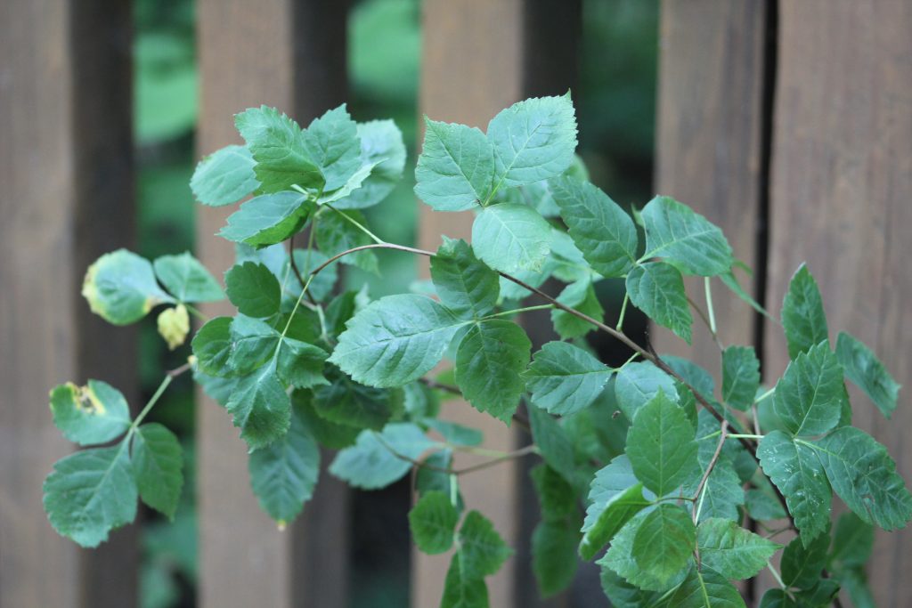
This plant has a peculiar bluish color to the leaves. The leafs are also trifoliately arranged (pinnately compound) and have lobed leaf margins.
American Hackberry
(Celtis occidentalis)
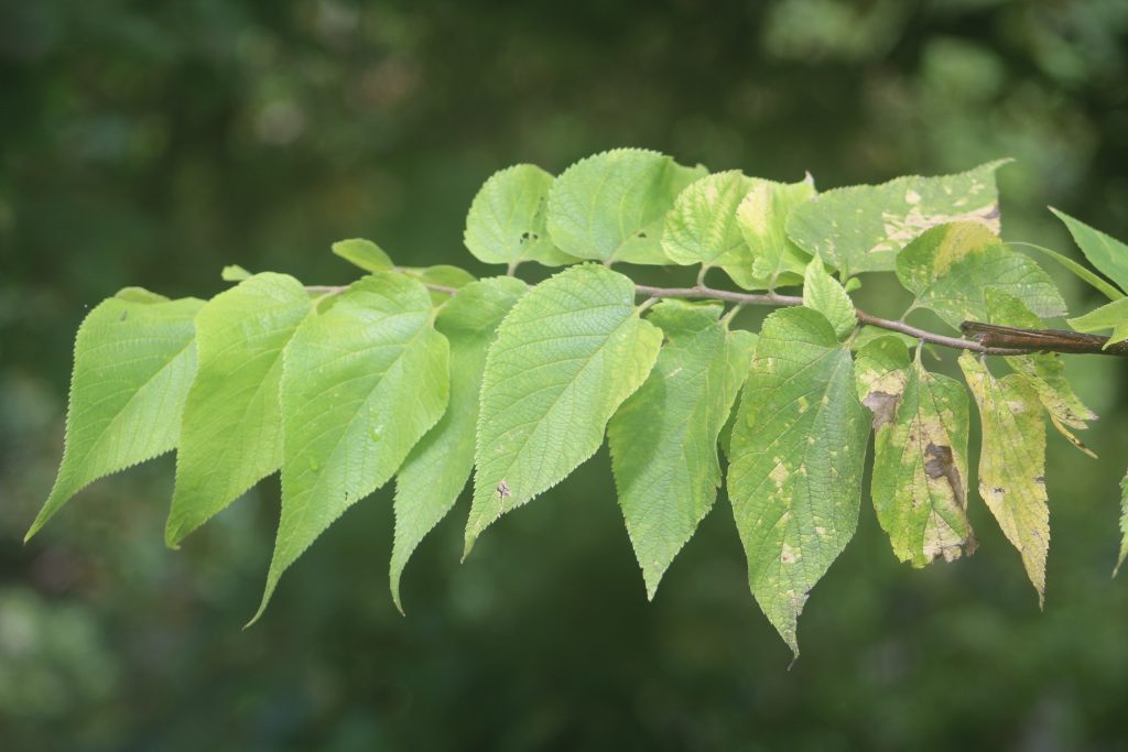
American Hackberry branch with almost sandpaper feeling leaves. Some sort of leave disease is also present on this branch.
5 species of trees/shrubs with a limited distribution to high-lime, clay-rich substrates (glacial till of western Ohio):
- Eastern Redbud (Cercis canadensis)
- Chinquapin Oak (Quercus muehlenbergii)
- Eastern Red-cedar (Juniperus virginiana)
- Eastern Hop Hornbeam (Ostrya virginiana)
- Hawthorn (Crateagus mollis)
5 species of trees/shrubs that have a distribution generally limited to sandstone hillcountry of eastern OH:
- Chestnut Oak (Quercus montana)
- Mountain Laurel (Kalmia latifolia)
- Hemlock (Tsuga canadensis)
- Mountain Maple (Acer spicatum)
- Sourwood (Oxydendrum arboreum)
Distribution of Substrate Picky Trees: The Sweet Buckeye, the Hemlock, and Rhododendron
The Sweet Buckeye (Aesculus flava) and the Hemlock (Tsuga canadensis) both have ranges that are highly restricted to the unglaciated regions of Ohio that are in the southeastern part of the state. The Hemlock probably prefers this unglaciated region because it has more deep valleys and ravines that provide a climate that is cooler and more moist. The erosion of the sandstone into these deep ravines is what has allowed these trees to flourish in the area. The Sweet Buckeye is probably limited since it can’t reproduce properly in areas that are high in limestone (where glacial till occurred). Finally, the Rhododendron species is also only found south of the glacial boundary since it is used to the Appalachian highlands and when the environment was changed by the glaciers north of the boundary it didn’t persist. It most likely used the Teays River to migrate into southeastern Appalachian Ohio.
All of the information and other factoids about geobotany come from “Linking Geology and Botany… a new approach” by Jane L. Forsyth at Bowling Green State University. If you are interested in reading more of the source material go to this link here to read the full pdf: GEOBOTANY-ARTICLE
Part B: Batelle Darby Metro Park (wetland, prairie, and lime-loving plants)
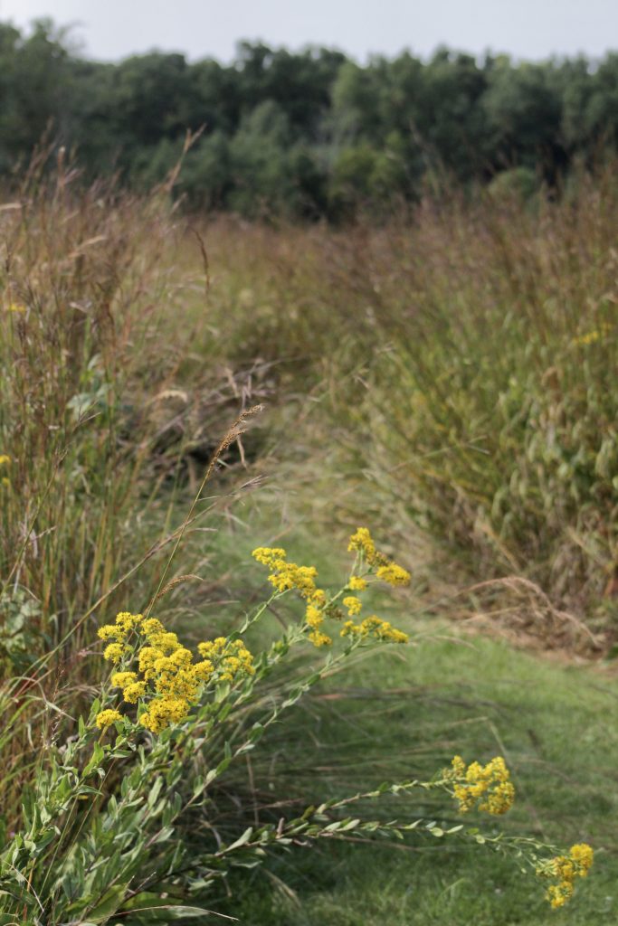
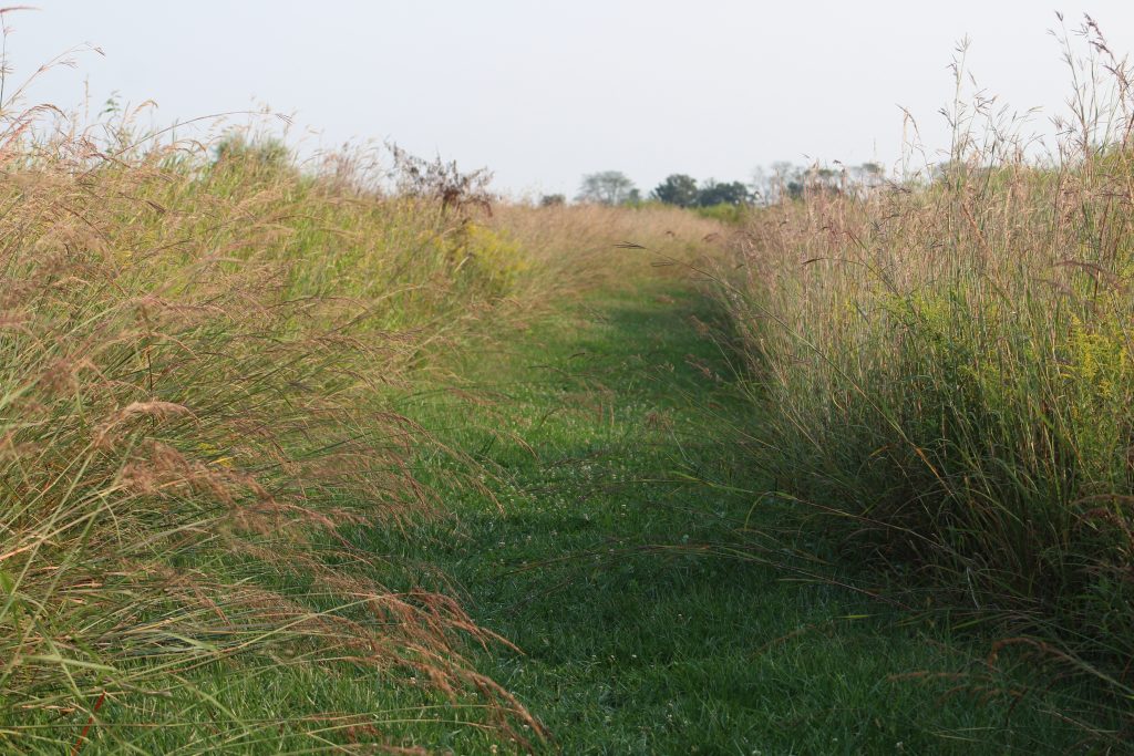
Turkey Foot Prairie Trail at Batelle Darby Metro Park. A windy mowed path through many native grasses, sedges, trees, and wildflowers.
In addition to exploring many plant species of Cedar Bog (which we’ll see later in the article) and the specialists of limestone and sandstone areas of Ohio, I also got to see some native prairie species at Batelle Darby Metro Park, in Galloway, Ohio. In particular, I was assigned to find two wet prairie adapted tree species to write about in my photo article as a part of my additional ‘scavenger hunt’ project.
The trees I had the chance to photograph were all actually at the Wet Prairie and Teal Trail at the first stop our group made (which satisfies the wetland component of the assignment). The first tree I have is the Crack Willow (Salix fragilis) which was located just off to the side of the main trail. This tree is one of the most common Ohio willows and was believed to be introduced to the area before coming naturalized in wet areas with full sun (according to uwgb.edu). One fun fact about the crack willow is that it has flexible stems which make it great for weaving baskets! In order to recognize the Crack Willow, one should keep a look out for an often large sized tree with leaflets that are lanceolate shaped and are alternately arranged. The stems in younger plants are also often reddish. These willows also sometimes have specialized flowers called catkins which can be an identification characteristic.
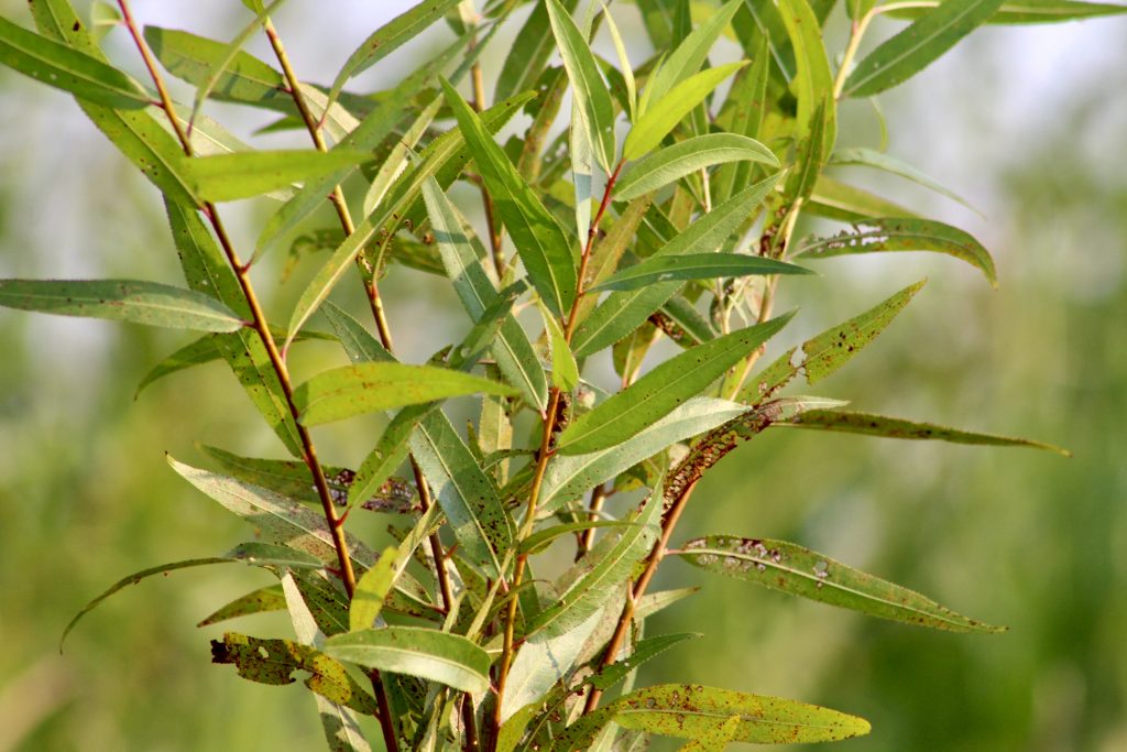
A Crack Willow (Salix fragilis) up close and personal at the Wet Prairie and Teal Trail at Batelle Darby.
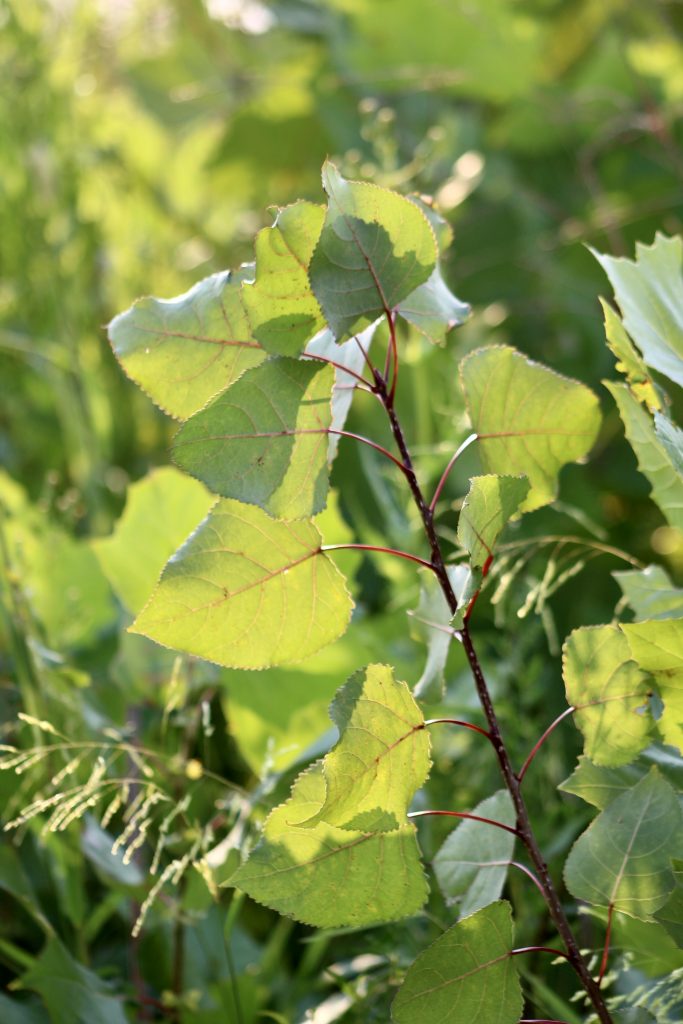
Eastern cottonwood (Populus deltoides)
Continuing with the lime-loving plants of Batelle Darby, we have our next specialist tree: the Eastern Cottonwood (Populus deltoides). This plant is also in the willow family, known as Salicaceae, and is often large tree that can grow to more than 100 feet tall! Another characteristic shared with the Crack Willow is that the Eastern Cottonwood also has catkins that are wind-pollinated. It can be distinguished from the Crack Willow with its ‘triangle-like’ leaves that also have flat stems that allow the leaves to flutter anxiously in the slightest breeze. In the younger plants, one can also see the red stems and branches again. One natural history fact about the Eastern Cottonwood is that its range extends much farther north into Canada where it provides habitat for northern nesting bird species such as the Yellow-rumped (Myrtle) Warbler and White-throated Sparrow.
In addition to two wetland specialist trees, I also saw a number of plants at the three spots we visited at the Batelle Darby Metro Park Area. After visiting the Wetland and Teal Trail, we also visited the Cedar Ridge area which was more of a forested habitat overlooking a ravine and finally the Turkey Foot Trail which was an example of another prairie.
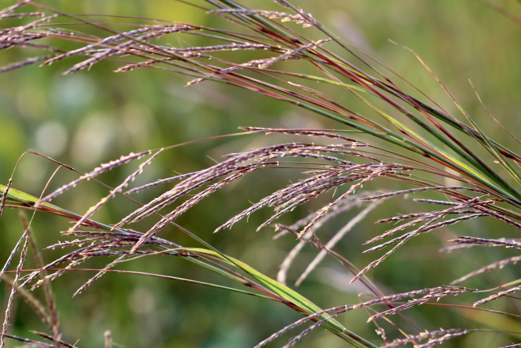
This is some sort of bluestem grass (though it looks quite purple to me) that is known colloquially as ‘turkeyfoot grass.’ If you were to take the ends of the grass seed head and spread them out in your hand you can imagine that it would look similar to a fowl’s splayed foot.
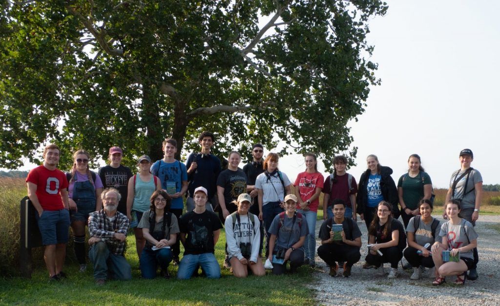
A photo of us at the Wet Prairie and Teal Trail before heading off to the next location. Photo credits to Dr. Bob Klips! You can see an American Sycamore (Platanus occidentalis) in the background too. See that one person with the reddish hair and bandanna? hehe that’s me!
A photo of the Wetland Prairie and Teal Trail at Batelle Darby Metro Park. You can see the bluestem grasses again as well as some species in the Solidago genus (goldenrods) poking their inflorescences out on the right. This trail has a central wetland that fills up in late winter and becomes a mudflat by late July. It is a great stopover site for many wading bird species in last summer/early fall during their migration. Many species such as Pectoral Sandpiper, American Golden Plover, American Woodcock, and Wilson’s Snipe have been seen here regularly. In late winter during peak waterfowl migration when the water levels are higher, the wetland provides safe harbor for many duck and geese species as well.
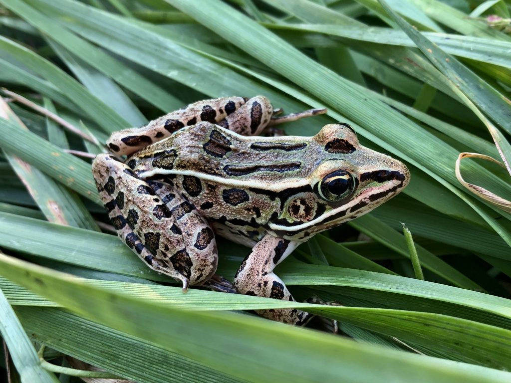
A Leopard frog (genus Lithobates) stands out (or blends in???) in the grass along the path of the Wetland Prairie and Teal Trail.
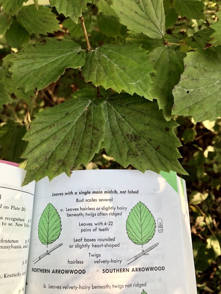
Identifying the Northern Arrowwood (Viburnum recognitum)
Cedar Ridge Area of Batelle Darby Metro Park
When it comes to identification, I used the Newcomb’s Guide to Wildflower and the Peterson Guide to Trees and Shrubs (as already stated). These guides were really helpful when it came to discovering new species. The species descriptions and ranges are quite helpful as well as the drawn images of the leaves, twigs, bugs, and leaf scars.
The plant on the right I managed to identify to Northern Arrowwood which I distinguished from the Southern Arrowwood. When I felt the twigs they were hairless and not at all velvety which led to my identification. This was about the only identification characteristic that was helpful for distinguishing between the two.
This was one of the species I managed to find at the Cedar Ridge parking area at Batelle Darby Metro Park. Other species at the site included Blue Ash, Hop Hornbeam, American Hackberry, Fragmant Sumac, Chinquapin Oak, Blue Ash, and American Basswood.

Some sort of snail I picked up along the way. He left a slime trail all over my hand and some of the other students (I was happy to share).
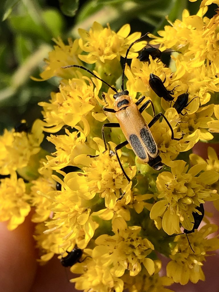
A Goldenrod Soldier Beetle on some sort of plant in the Asteraceae family.
Turkeyfoot Trail at Batelle Darby Metro Park
The third and final stop at Batelle Darby Metro Park was at the Turkeyfoot trail t0 see some prairie and forest edge dwelling species pressing on to Cedar Bog.
Some plants our class found here include New England Aster, Climbing False Buckweed, Giant Ragweed, Prairie Doc, Bur Oak, Stiff-leaved Goldenrod, Bergamot, and Riverbank Grape just to name a few.
Despite how much I enjoyed seeing the plants, I can never seem to focus on just one kingdom… I made some other friends along the way. I also saw some sort of species of Leopard frog, many insects including beetles, Lepidoptera, and snails, and a few birds as well. I have some photos of these species interspersed amongst my botanical photos.
One particular species I saw several times was intermixed with black beetles (see left). He has two black, oblong spots on his orange outer wings, a spot on his thorax, and long antennae. Based on my research, I believe this insect is a Goldenrod Soldier Beetle (Chauliognathus pensylvanicus). Apparently they are closely related to lightning bugs and feed on pollen, nectar, and other small insects.
To learn more about prairie specialist insects visit this link here by St. Olaf College. This was also my source material for some of my other insect identifications.
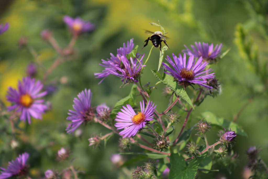
This New England Aster (Aster novae-angliae) is quite magnificent and can grow up to 6 feet high! You can see from the bee on the plant that it is quite attractive to pollinators as well as humans.
-
- The vine with white flowers is Climbing False Buckweed (Fallopia scandens). The plant it is climbing is Giant Ragweed (Ambrosia trifida).
-
- Dr. Klips holding up a plant in the Fabaceae family and Baptisia genus (mostly likely a false or wild indigo).
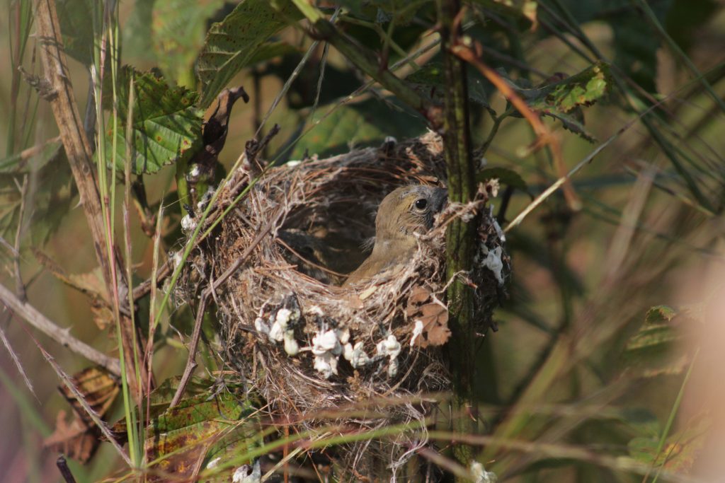
Some other students and I also found this nestling bird in a open-faced cup nest on the edge of the Turkeyfoot prairie trail. I am not entirely sure of the species but one of the only birds that next this late is the American Goldfinch (Spinus tristis). The reason they nest so late is to align their growing nestlings with the native thistle seed crops. American Goldfinches are one of the only species of the birds that are solely insectivores and even feed seeds to their young in lieu of live insects for much of their diet.
Part C: Cedar Bog (that isn’t a bog)
The Cedar Bog State Nature Preserve is a bit of misnomer because it is in fact not a bog at all but a FEN! One way to remember the difference is through rhyme: fens flow and bogs clog! Water enters the fen by rain, surface runoff from uplands, underground springs from glacial moraines, and deep groundwater leftover from the Teays River. The water eventually leaves the fen through small streams which flushes the system. The groundwater that flows through the fen dissolves the limestone resulting in a system that is predominantly neutral pH or even slightly alkaline. In comparison, a bog also has water enter via rain and surface runoff, but water can really only escape the bog through evaporation (no way to flow out from the bog). Since there is no active flow, dead plants pile up on themselves which form a layer of peat that becomes acidic as the plant matter decomposes. Besides the differing pH and geology of Cedar Bog, it also has its own unique microclimate that is akin to the average weather patterns of the north part of the lower peninsula of Michigan. As a result of these unique environmental features, many of the species in the fen are disjunct populations that are normally in range farther north. Because the fen is always flowing due to groundwater from glacial deposits, it is also not as affected by drought. This allows Cedar Bog to have species that are less drought tolerant and more appreciative of a moist environment.
My short summary on the unique climate and geology of Cedar Bog SNP is adapted from the interpretive materials seen at the Cedar Bog nature center. To see some of these posters and infographics you can visit Cedar Bog Interpretive Posters on the class Ohio plants website. Another great source of information about Cedar Bog is in an Ohio Journal of Science article by Clara May Frederick that is great reading: A Natural History Study of the Vascular Flora of Cedar Bog.
Now, for a little more botany fun… I have a series of photos including trees, shrubs, and herbaceous plants (some common and some rare) that I saw from the boardwalk at Cedar Bog. Enjoy!
-
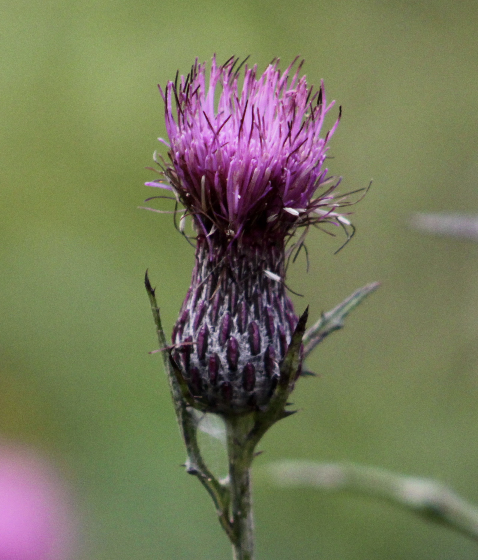
- This is the Swamp Thistle (Cirsium muticum) that we found at the beginning and throughout the boardwalk at the Cedar Bog. I believe it is supposed to be a rare thistle for the area. The base of the thistle flower looks quite different from all the others with dark purple flecks at the base of the discoid inflorescence.

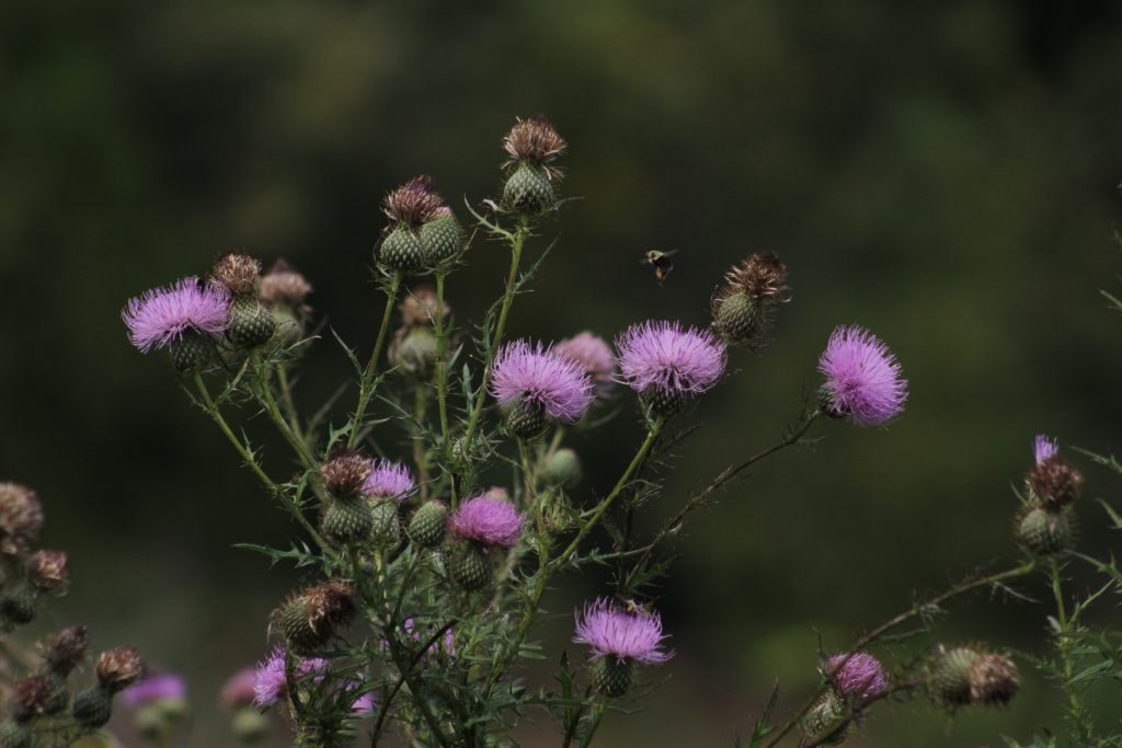
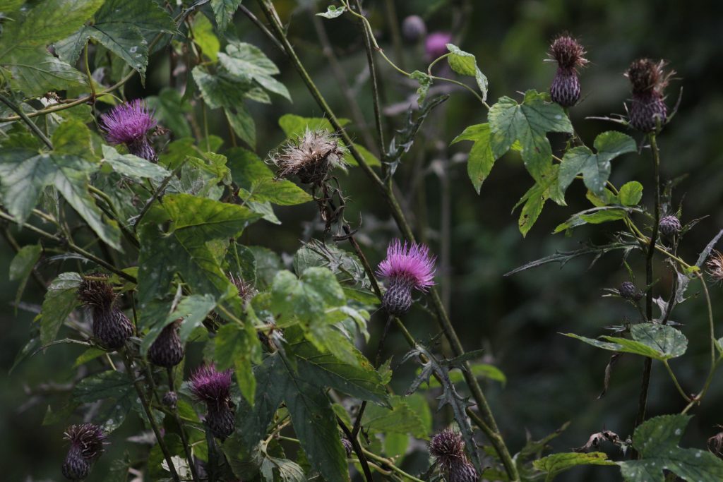
For reference this is another type of thistle that isn’t quite as rare as the Swamp Thistle. I believe it is the Field Thistle (Cirsium discolor) based on the deeply cut and smaller leaves.
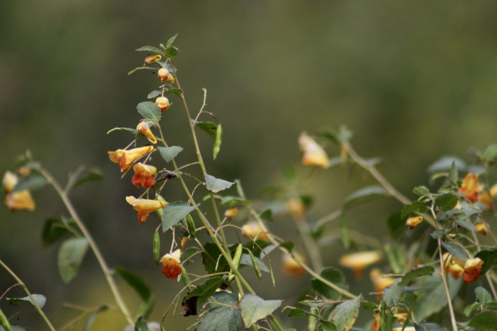
This is some species of Jewelweed, also known as a Touch-Me-Not that is in the Impatiens genus.
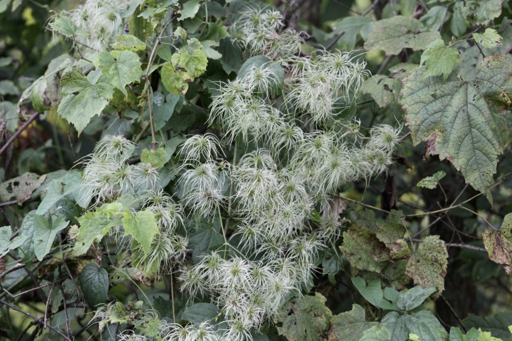
Virgin’s Bower (Clematis virginiana) is a woody perennial vine that prefers moist and shady wooded habitat.
-
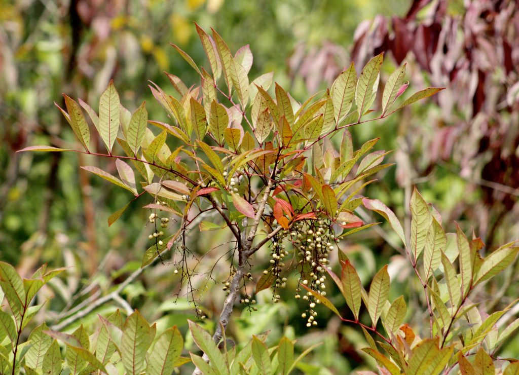
- These images are of Poison Sumac (Toxicodendron vernix) which is a shrub or small tree that prefers swamp areas. There were many of these shrubs at Cedar Bog that were laden with berries. Some of the branches were beginning to turn a gorgeous red color which inspired me to draw the plants.
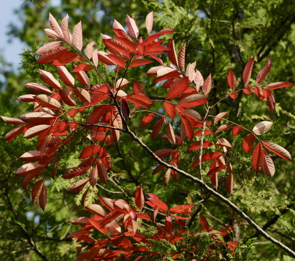
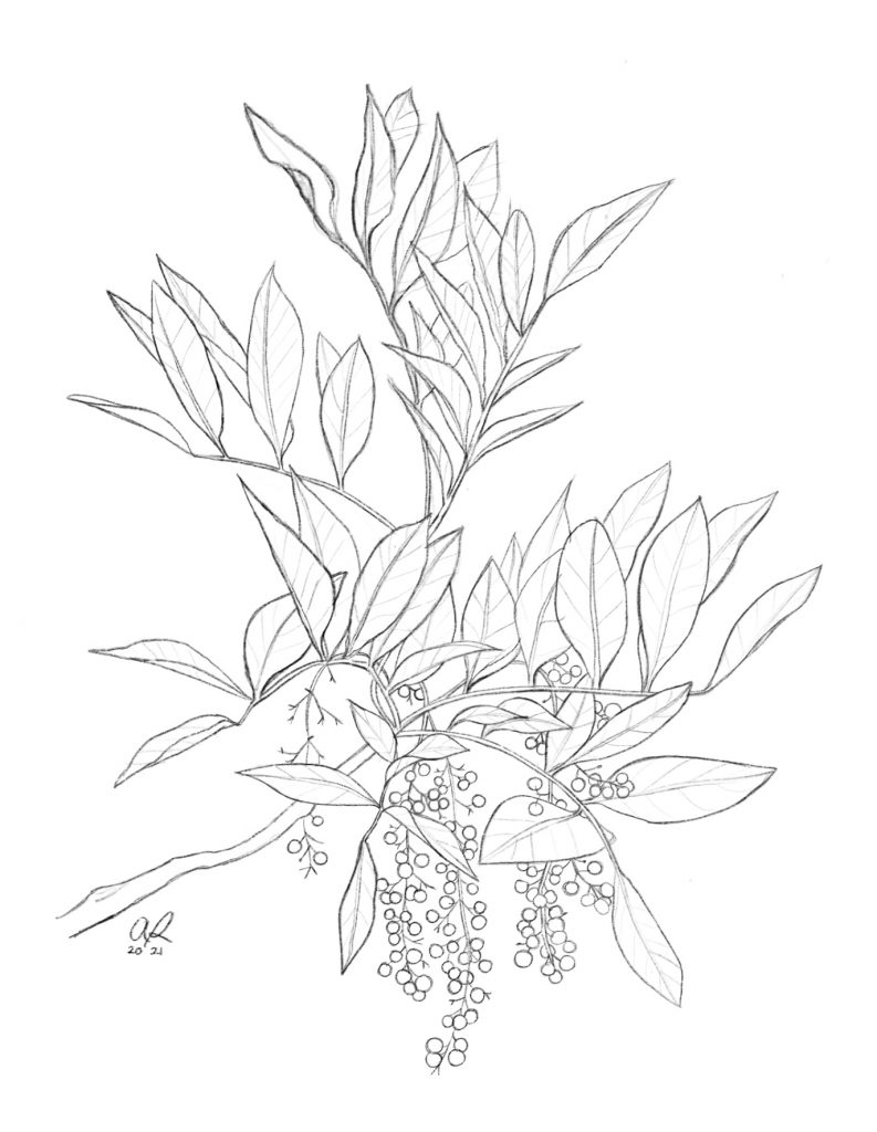
A Poison Sumac Branch with fruiting inflorescence that I drew based off of some reference photos I took at Cedar Bog (that isn’t a bog!) this late summer.
Our next couple species in the photo documentary are some trees that we saw from the Cedar Bog boardwalk (for a little break in our shrubs, vines and herbaceous plants). The photo below is of Black Ash (Fraxinus nigra) that can be distinguished from other ashes based on its sessile leaflets (that are oppositely arranged and pinnately compound). Instead of there be a short amount of stalk separating the stems and the leaflet like in the Green Ash (Fraxinus pennsylvanica), the plant instead has leaflets that begin immediately at the stalk.
Other trees seen at the bog include Northern White Cedar, Hop Hornbeam, Green Ash, Tulip tree, Spicebush, Chinquapin Oak, American Sycamore, Ninebark, Black Walnut, Eastern Redbud, American Hackberry, and Common Winterberry.
Black Ash leaves (Fraxinus nigra)
-
- Tulip tree leaves from below!
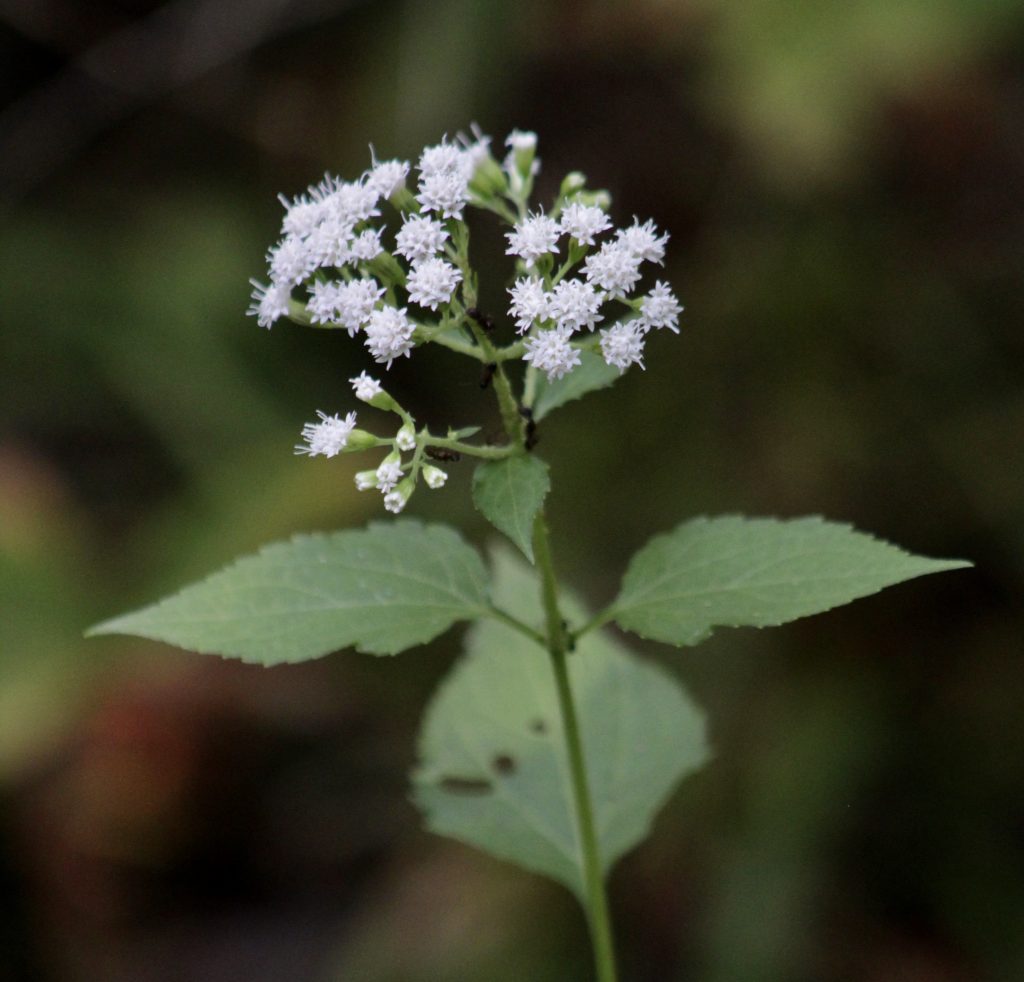
White Snakeroot (Ageratina altissima, formerly in the genus Eupatorium) was present nearly all along the boardwalk at Cedar Bog. It is a poisonous plant that when ingested by cattle can end up in the cow’s milk which can prove to be fatal to humans. This plant claimed the lives of many European settlers during the 19th century.
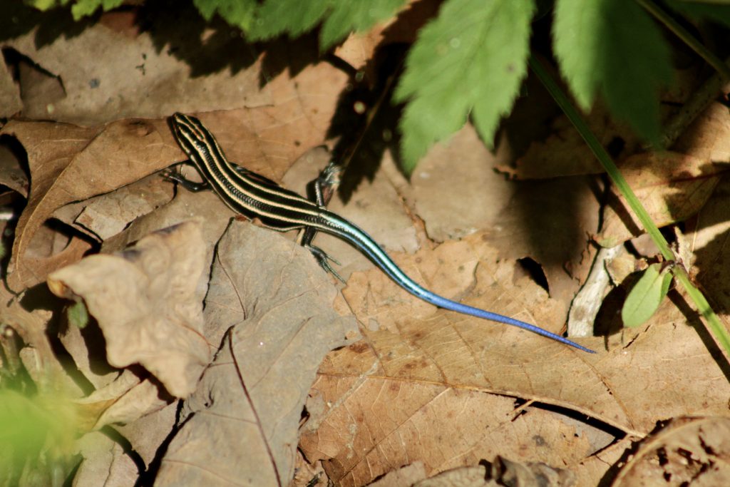
To add a reptile to the bunch we have the Five-lined Skink (Plestiodon fasciatus)!
-
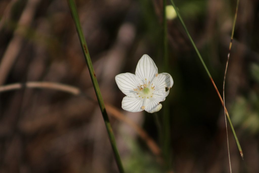
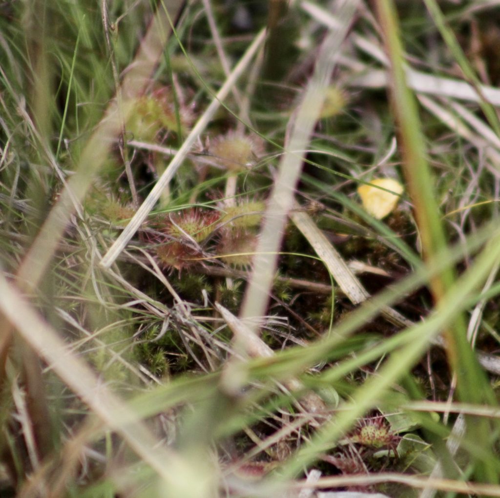
- The plant above is a Grass of Parnassus, what a pretty flower! On the right we also have a very special plant: Sundew (genus Drosera) which is in the family Doseraceae. This is actually a carnivorous plant that calls the fen home! This genus has over 100 species. There is much debate on whether some of these carnivorous plants are native to the area or brought over from Europe several centuries ago.
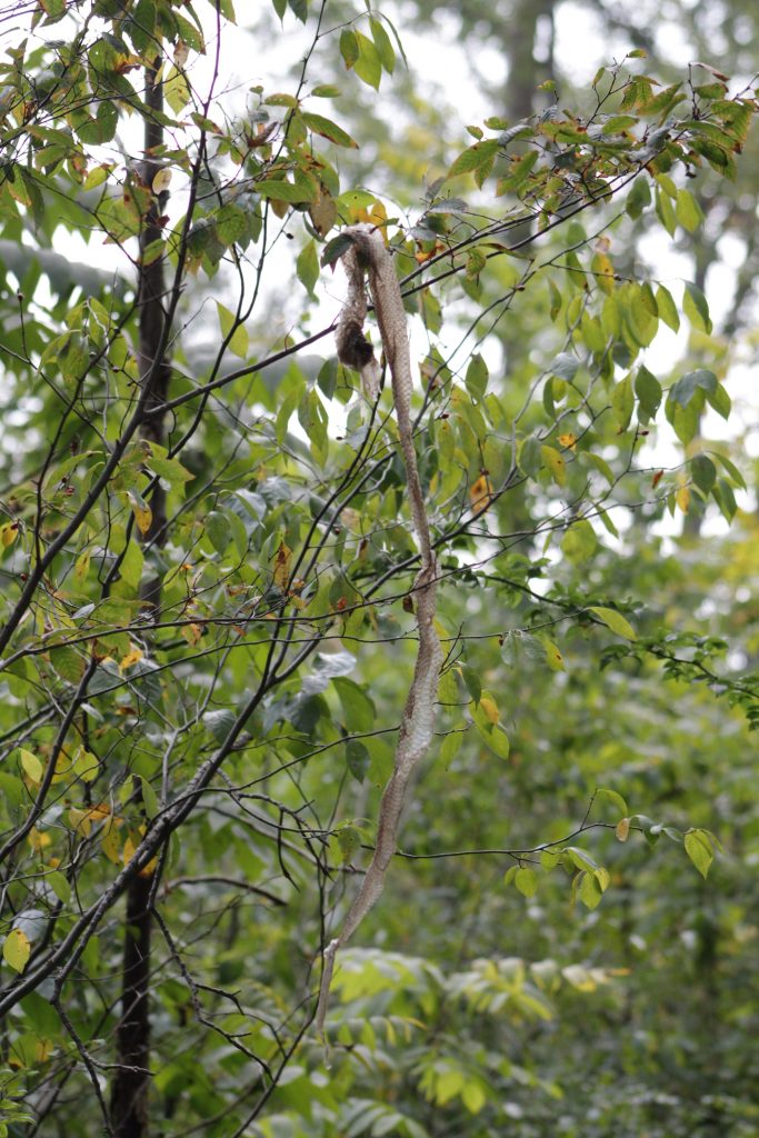
Rattlesnake Skin!
Another reptile species that occurs in the Cedar Bog is the Eastern Massasauga Rattlesnake (Sistrurus catenatus). This snake can grow up to 30 inches long and is dark colored and stocky with black stripes. It is a venomous snake but it is hardly ever seen and will only ever bite if severely provoked. The rattlesnake has been listed as an endangered species in Ohio since the late 90s mainly due to loss of habitat that they can thrive and breed in. When much of Ohio’s prairies and swamplands were drained, tilled, and turned into farmland the population of rattlesnakes was greatly reduced.
The rattlesnake is also rarely ever seen on the Cedar Bog boardwalk. Even some of the volunteers there have never seen one! Here in the tree though I believe one of the docents on the boardwalk hung up this snake skin of the Massasauga Rattlesnake for everyone to admire.
To read more information about the Massasauga Rattlesnake you can visit the website where I gathered a lot of the facts I learned for this article. Visit the link here at the Ohio History Connection to read more!
-
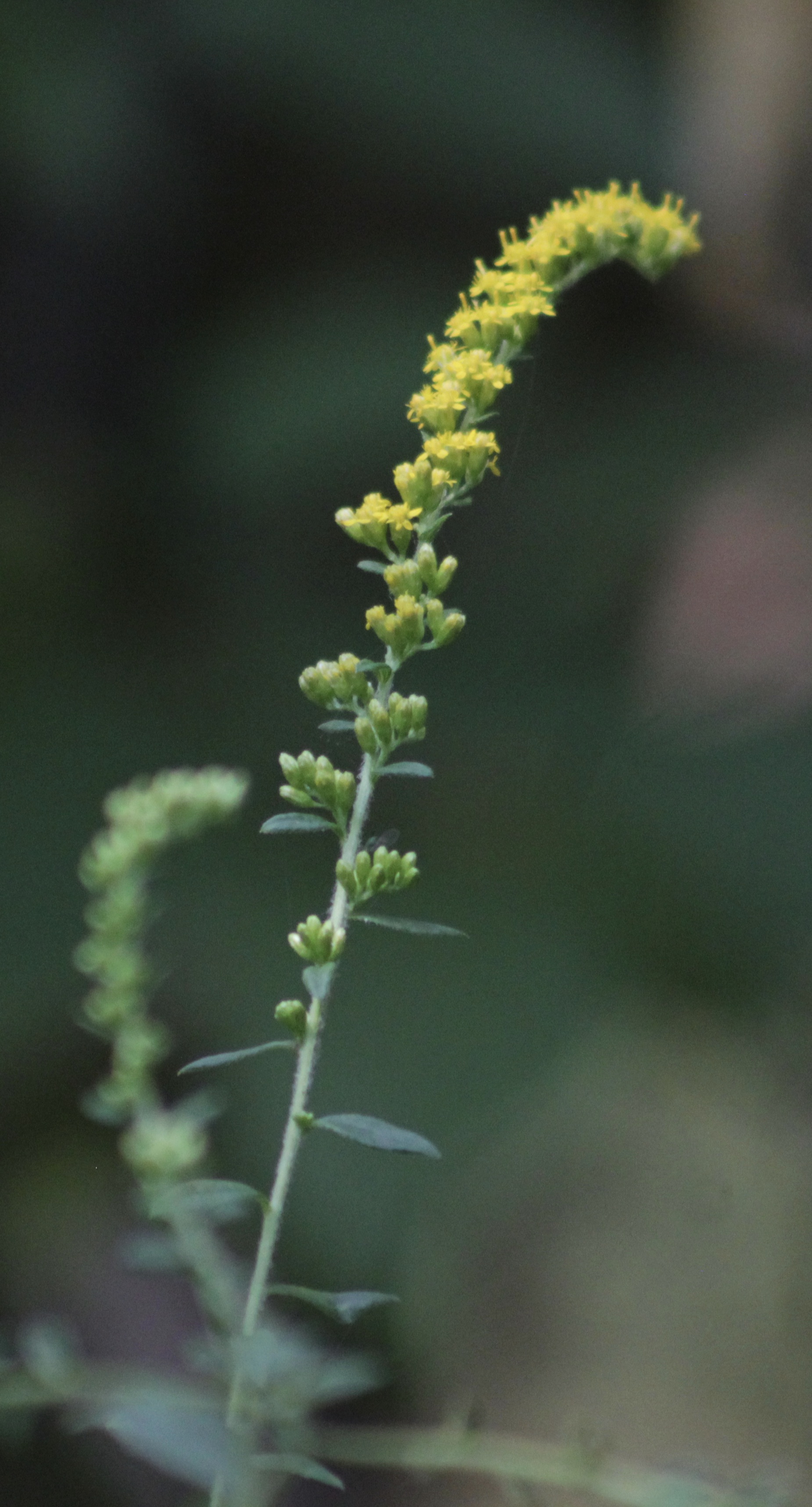
- Various plants in the Solidago (Goldenrod) family.
The Cedar Bog boardwalk also had many species of goldenrod in the Solidago genus as well. I am personally not equipped with the knowledge to identify many of the species that we saw (I had lots of problems keying the goldenrod) but Dr. Klips and some of the other species managed to identify some plants down to species. Some of the species include Rough-leaved Goldenrod (Solidago patula), Ohio Goldenrod (Solidago ohioensis), and Wrinkleleaf Goldenrod (Solidago rugosa).
Below, we also have a few images of the hyper rare Swamp Birch (Betula pumila) which is native to various bog and swamp habitats (including our fen!). One way to distinguish it from other birches is that it has soft and hairy twigs and dark kidney-shaped leaves.
Swamp Birch (Betula pumila)
-
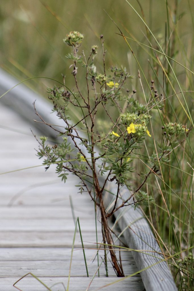
- The top photo is yet another photo of the Swamp Birch which is an extremely rare plant! Another rare plant is on the right called Shrubby Cinquefoil (Dasiphora fruticosa). The cinquefoil can grow up to 4 feet tail and has yellow flowers. You can see it growing up through the boardwalk in the photo on the right.
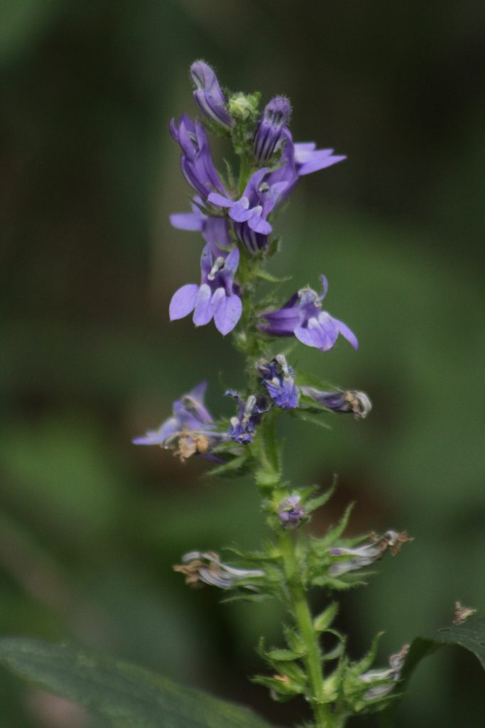
-
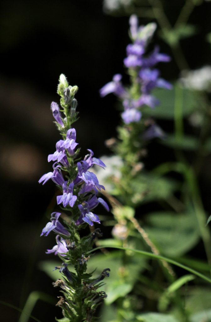
- Great Lobelia (Lobelia siphilitica)
There were so many plants to photograph! And many plants that I didn’t have enough time to photograph. Some of the other plants seen at the boardwalk included Virginia Creeper, Multiflora Rose, orchids, Swamp Lousewort, Turtle’s head, Riverbank Grape, Ninebark, Ironweeds, Spicebush, and Common Winterberry.